Bedretto Underground Laboratory for Geosciences and Geoenergies
The BedrettoLab (Bedretto Underground Laboratory for Geosciences and Geoenergies) is a unique research infrastructure run by ETH Zurich making it possible to take a close look at the Earth’s interior. It is located in the Swiss Alps 1.5 kilometres below the surface and in the middle of a 5.2 kilometres long tunnel connecting the Ticino with the Furka railway tunnel.
Equipped with the latest technology, the BedrettoLab offers ideal conditions to conduct experimental research focusing on the behaviour of the deep underground when accessing and stimulating it. Such an access is required to advance scientific knowledge in various domains including geothermal energy and earthquake physics. It is also of relevance to develop novel techniques and sensors for these purposes.
2024-04-12
First long-term injection experiment starting in mid-April
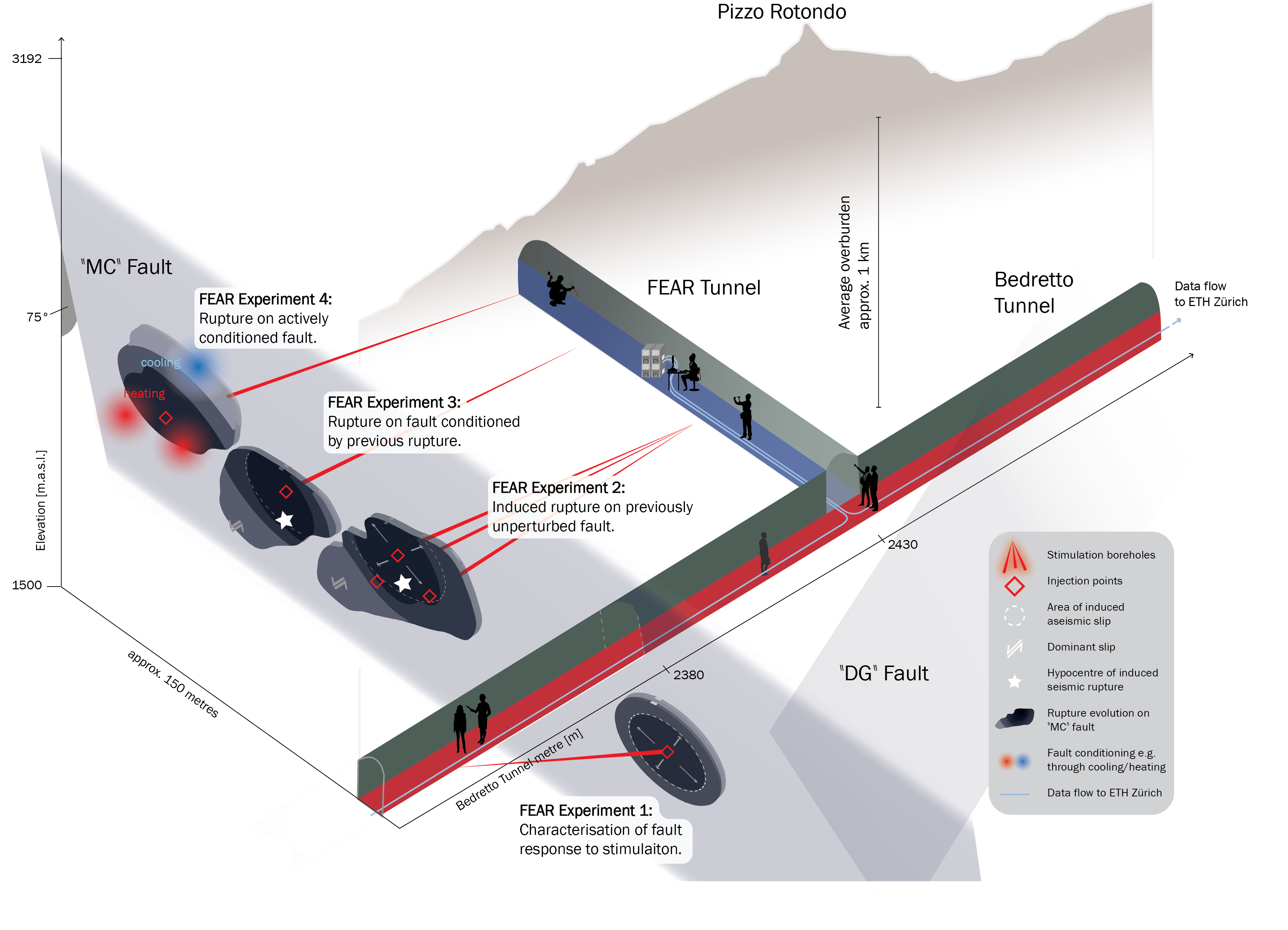
The BedrettoLab team is embarking on a new phase of experiments. As part of the FEAR project, a sequence of hydraulic stimulation experiments will start in mid-April. Leveraging on insights gained from the VALTER experiments, the team plans continued injections for an extended period of two to four days, allowing the reactivation and extension of the fracture network of the reservoir created in past experiments. Scientifically, the team is focusing mainly on the seismic response of the reservoir and aims to scale up the seismicity to larger events than previously observed.
In past experiments, the largest observed micro-earthquake was about a magnitude -2; in the upcoming M0 experiment, the team strives to reach about a magnitude 0. Such an event is about 100 times larger in amplitude and releases about 1´000 times more energy than a magnitude -2. Such an event would rupture a patch of about two by two meters by about one centimetre, allowing us to study when and where such a micro-earthquake starts, how it ruptures, and when it stops. For comparison, a natural earthquake of magnitude 6 that occurs in Switzerland every 50 to 150 years ruptures a patch of 10 by 10 kilometres by one meter, releasing about 1 billion times more energy.
Magnitude 0 events have already occurred naturally in the vicinity of the tunnel, and such micro-earthquakes remain about 100 to 1’000 times too small to be felt by people in the Bedretto Valley at a distance of several kilometres. The likelihood of induced larger events that could be detected in the Bedretto Valley remains extremely low. However, even micro-earthquakes of magnitude zero to one can be felt if experienced within a few meters or tens of meters of them. To eliminate even the smallest risk to people in the tunnel, these experiments will not only be very closely monitored, but they will also for the first time be fully remote controlled. During the main injection, no people will be allowed in the tunnel. This remote-control capability will be even more important later in the FEAR project when patches of 10 meters are the target size.
During the main part of the experiment, about twenty dedicated members of the BedrettoLab team will be working in 24/7 shifts over a period of one week. Their primary task will be to monitor the pressure, flow rate, deformation, and seismicity behaviour in real-time. The geobiological and geochemical response of the reservoir will also be closely monitored, for example, to detect pre-cursors before larger ruptures. As implemented for previous experiments, two traffic light systems regulate the experiment, and if the observed vibrations or magnitude exceed pre-defined thresholds, the experiment will be ended immediately and bleed-off initiated; past experiments have shown that seismicity will then within minutes to hours decrease strongly.
2024-04-02
New project to test thermal energy storage in fractured rocks
A new project entitled ‘BEACH: Bedretto Energy Storage and Circulation of Geothermal Energy’ just started with a first meeting of the consortium. It is a pilot and demonstration project funded by the Swiss Federal Office of Energy (SFOE) dedicated to testing, developing, and introducing new technologies from research to the Swiss industrial market.
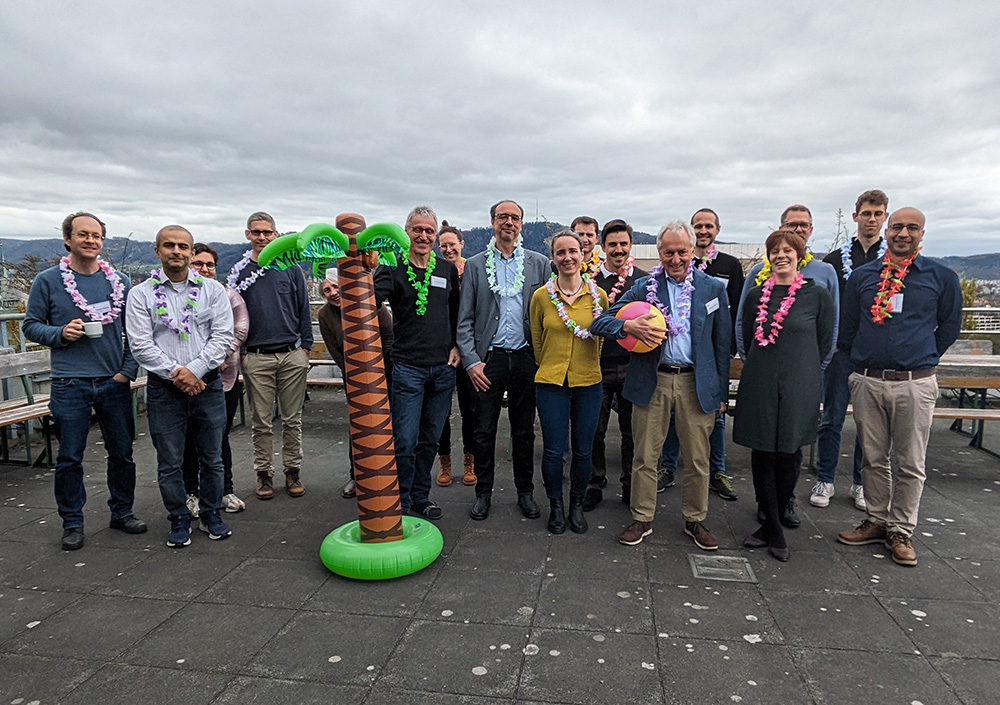
The project consortium consists of scientists from the BedrettoLab, the Geothermal Energy and Geofluids group at ETH Zurich, researchers from SUPSI, and industry experts from Azienda Elettrica Ticinese (AET) as well as Geo-Energie Suisse (GES).
BEACH will play a key role in tackling the challenges of the Swiss energy transition by demonstrating a new technology for storing and retrieving energy in the subsurface. With the energy grid shifting towards renewable energies such as wind or solar energy, seasonal phases of energy demand surplus demand for an efficient and sustainable solution for energy storage. While thermal energy storage in soft sediments (e.g. in the Netherlands) is well established, storing heat in the hard, fractured rock most common in Switzerland remains largely unexplored. The BEACH project will explore a so-called fractured thermal energy storage in the limited permeability of the crystalline rocks in the BedrettoLab.
For demonstrating the feasibility, warm water (30 - 70 °C) will be injected into existing fractures, where it will be stored and kept warm by the surrounding rock until it will be retrieved again. In a real-world roll-out scenario, the heat could then be converted into energy or used for district heating.
The tests are accompanied by comprehensive real-time-monitoring and numerical simulations for optimizing the geothermal energy system. Ultimately, the technology will be proposed on a cantonal and national level for real-scale sites to be realized by industrial partners as an additional part of the project. A real-scale reservoir in crystalline rock could be established close to infrastructures with high energy excess and/or demand, such as industrial areas, at depths of around 1 to 3 kilometers.
Maren Brehme from ETH Zurich leads the BEACH project awarded with a fund of 2.96 Mio CHF. The community of Bedretto and the canton of Ticino support the project in rolling out the technology on a national level.
Virtual Tour
Click on play and get a deep insight into the BedrettoLab.
Geo-INQUIRE call #1 open
The EU Project Geo-INQUIRE (Geosphere INfrastructures for QUestions into Integrated REsearch) fosters excellent, interdisciplinary and curiosity-driven research of the solid Earth, including land-sea-atmosphere interfaces. An objective of project Geo-INQUIRE is to provide transnational access to unique high-level installations and experiments to selected users to perform research. The BedrettoLab and its three testbeds (Geothermal Testbed, Earthquake Physics Tesbed and the Deep Life Observatory) are made available to the research community through the 1st Open Call for projects, open between January 15th and March 15th. For further information and to apply please visit the Geo-INQUIRE website.


